

Uwharrie Scenic Road
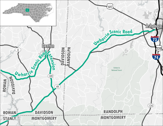
This byway journeys begins in Asheboro (Randolph County) at the intersection of US-64 and NC-49. The route follows NC-49 and Old NC-49 through Randolph and Davidson counties, concluding in Concord at the intersection with Old Charlotte Road. Motorists will travel through the Uwharrie Mountains in the area known as the "Carolina State Belt". These isolated mountain peaks were formed several hundred million years ago by volcanoes.
Travelers have the option to drive the Uwharrie Scenic Road Extension, heading up NC-109 through Denton (Davidson County) and then along Lick Creek Church Road west to the Yadkin River.
| Counties: | Randolph, Davidson, Rowan, Stanly, Cabarrus |
| Distance: | 50.7 Miles (Route) 14.9 Miles (Extension) |
| Time: | 56 Minutes (Route) 20 Minutes (Extension) |


